Monte Rosa
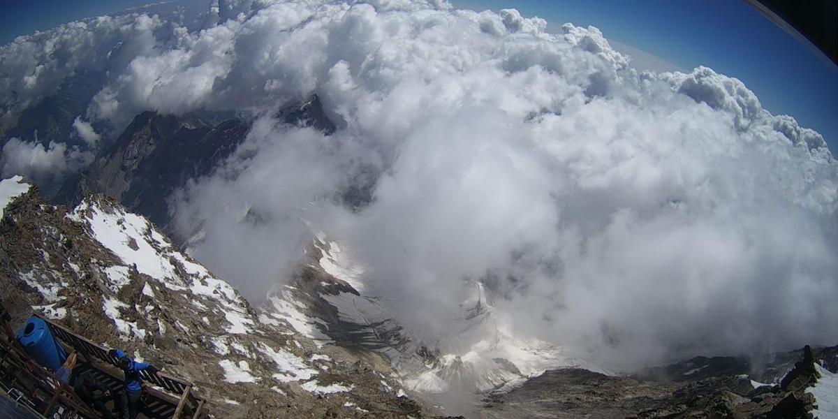
The Monte Rosa is the great mountain group of the Pennine Alps that marks the watershed between Italy and Switzerland: with the Punta Dufour it rises above 4600 metres and is, in Europe, second only to Mont Blanc[1]. The massif covers about 290 square kilometres with an average height of 2900 metres; on the Italian side four deep valleys descend from it, the Valle d'Ayas, the Val di Gressoney, the Valsesia and the Valle Anzasca[2]. For Piedmont it is the mountain of the Walser colonies, of nineteenth-century pioneering mountaineering, and of high-altitude physiology born at the University of Turin; today it is also one of the places where the warming of the Alps can best be measured.
The name and the peaks
The colour has nothing to do with it: in documents from the 15th and 16th centuries the mountain appears as "Monte della Roisa", and the dialect term roiza or roise seems simply to indicate the glacier[2]. The massif is made up of crystalline eruptive and metamorphic rocks[1]. From west to east stand the Breithorn, the Castore, the Lyskamm, the Punta Gnifetti, the Punta Dufour and the Nordend, joined by the Piramide Vincent and the Punta Giordani[2]. The elevations vary by a few metres depending on the measurement: the online Treccani gives the Punta Dufour as 4637 metres and the Punta Gnifetti as 4554[1], while the Enciclopedia Italiana of the 1930s gives 4638 and 4559 respectively[2].
The largest glaciers lie on the Swiss side: the Gorner, which the old Enciclopedia Italiana measured at 67.3 square kilometres and 14 kilometres in length, the second largest in the Alps, and the Findelen; on the Italian side are the glaciers of Verra, Lys and Macugnaga[2].
The Walser valleys
South and east of the Rosa live the Walser communities, German-speaking populations who set out from the upper Valais and spread through the Alpine valleys starting in the first half of the thirteenth century: Gressoney-La-Trinité, Gressoney-Saint-Jean and Issime in the Lys valley, Macugnaga in the Valle Anzasca, and Alagna, Rima and Rimella in the Valsesia[3]. Their demographic growth peaked in the early decades of the nineteenth century; decline then reduced them to a few thousand people, who preserve their language, customs and a distinctive architecture and today live largely on tourism[3]. Macugnaga, at 1327 metres in the Valle Anzasca, is one of these colonies: founded by settlers from the Valais in the thirteenth century, a German dialect is still spoken there and it is today a well-known tourist centre[4].
The conquest of the summits
The mountaineering history of the Rosa begins on the Valsesia side. On 23 July 1801 Pietro Giordani, a doctor in Alagna, climbed toward the peak that bears his name, although it is not fully proven that he reached the summit; in 1819 Nicola Vincent of Gressoney reached the pyramid now named after him, and the following year, together with Joseph Zumstein and others, the Punta Zumstein[2]. The most tenacious protagonist was the parish priest of Alagna, Giovanni Gnifetti: in 1834 his party stopped just above 4100 metres because of altitude sickness and the reckless consumption of alcohol; in 1836, half an hour from the summit, the group realised they had forgotten their crampons and ice axes; in 1839 bad weather turned them back[5]. On the fourth attempt, an expedition of eight people, including two porters, set out on 8 August 1842 and the following day, 9 August, reached the Punta del Segnale, the Signalkuppe, today the Punta Gnifetti; two nephews of the priest, the cleric G. Farinetti and G. Giordani, raised there a large red flag visible from the whole upper Valsesia[5][2]. In Gnifetti's account, the arrival at the summit was greeted with
"unanimous and spontaneous […] cheers for Carlo Alberto and the Royal House of Savoy"
The book, printed in Turin and reprinted several times, is considered a classic of the pioneering phase of mountaineering; in it the priest appears as a liberal, a supporter of education and of the Walser speech of his parishioners[5]. The cheers for Carlo Alberto and the House of Savoy, sovereigns of the Kingdom of Sardinia, are read by the Dizionario Biografico as a sign of the priest's liberal-leaning positions[5].
The highest summit, the Punta Dufour, was reached in 1848 by two guides from Zermatt and then, on 31 July 1851, by an English party with four guides, among them Charles Hudson, who later died on the Matterhorn; the Lyskamm fell in 1861[2]. Two years later, on 23 October 1863, following the August ascent of Monviso, Quintino Sella, born in Sella di Mosso in the Biella area, founded the Italian Alpine Club[6]. The first winter ascent of the Rosa bears the same surname: it was made by Vittorio Sella[2].
Europe's highest laboratory
In 1893 the Capanna Osservatorio Regina Margherita was inaugurated on the Punta Gnifetti[1]; the queen spent the night there on 18 and 19 August of that year[2]. In her final years Margherita spent increasingly long periods between Bordighera and Gressoney, at the foot of the massif[7]. The refuge soon became a centre of study, above all meteorological[2]. It was turned into a laboratory by the Turin physiologist Angelo Mosso, born in the city in 1846 and holder of the chair of physiology at the university: in 1895 he founded a scientific station there, followed in 1907 by a proper institute at the Col d'Olen[8]. His book Fisiologia dell'uomo sulle Alpi (Turin, 1897) is remembered as the founding act of high-altitude physiology, mountain medicine and aeronautical medicine[8].
The refuge's weather station, idle since 1958, resumed automatic readings in 2002 and is now run by Arpa Piemonte[9]. The study of glaciers also has a centre in Turin: the Comitato Glaciologico Italiano, active since 1895 and turned in 2025 into the Fondazione Glaciologica Italiana, is based on corso Massimo d'Azeglio[10].
A warming Rosa
Between 4 and 8 September 2023 the temperature at the top of the Rosa did not drop below zero for nearly five days in a row, the longest such spell in at least twenty years; on 6 September the refuge recorded 0.8 degrees[9]. The Gorner, which at the start of the twentieth century exceeded 67 square kilometres[2], today measures about 40 and has lost around 40 per cent of its surface area in a century and a half; in June 2021 the Ice Memory project extracted ice cores from the Gorner down to 82 metres in depth, which may hold climate data from ten thousand years ago, possibly the oldest ice in the Alps[11]. At the end of January 2023 a large crack was photographed on the summit ice cap of the Breithorn Occidentale, at 4165 metres; the glaciologist Giovanni Baccolo, speaking to the Italian Alpine Club's magazine, explained that the fracture had
"isolated a large portion of the glacier from the main body, turning it into an enormous serac"
According to the glaciologist, the fracture is due to the build-up of snow at altitude and to the possible shift of the glacier from cold to temperate, linked to global warming[12].
Pages linking here
Related articles: Biella, Umberto I
Sources
- Treccani
- Treccani – Enciclopedia Italiana
- Treccani
- Treccani
- Treccani – Dizionario Biografico degli Italiani
- Treccani – Dizionario Biografico degli Italiani
- Treccani – Dizionario Biografico degli Italiani
- Treccani – Dizionario Biografico degli Italiani
- Il Post — 11 September 2023
- Fondazione Glaciologica Italiana (Comitato Glaciologico Italiano)
- Il Post — 9 May 2022
- Il Post — 16 February 2023