Macugnaga
Macugnaga is a municipality in the upper Anzasca Valley, in the Ossola, lying at the foot of the east face of Monte Rosa. Founded in the 13th century by German-speaking settlers from the Valais, it was for centuries a village of gold miners and then, from the 19th century onward, one of the cradles of Italian mountaineering. In contemporary Piedmont it is best known as a ski and hiking resort and as a natural observatory for the changes affecting Alpine glaciers.
The Walser colony
The settlement arose between 1260 and 1290, when Count Gotofredo di Biandrate, seeking to strengthen his hold over the valleys east of Monte Rosa, encouraged families from Saas, in the Swiss Valais, to settle there. These colonists, the Walser, brought with them Titsch, their Germanic dialect, quite different from the Piedmontese language.[1] The small hamlet of Dorf still preserves its Blockbau houses, built from interlocking larch logs.[2]
The heart of the community was the Old Church, dedicated to Santa Maria: according to the cultural association Piemonteis it was built starting in 1260, with the bell tower dating from 1580;[1] the earliest document mentioning it is a deed of 1317 signed under its portico.[2] Beside it stands the Old Linden Tree, in whose shade the Greater Council, known as the «Council of Vicinanza», used to meet.[1] Estimates of the tree's age differ: about five centuries according to Piemonteis,[1] over seven hundred years, with a trunk circumference of 7 metres at the base, according to the town's tourism website.[2]
The gold of the Anzasca Valley
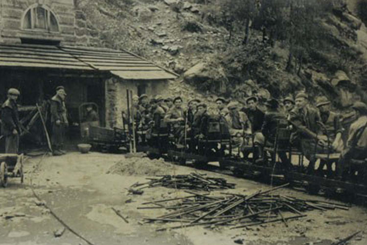
A document from 1291 already mentions the «homines argentarii», the men who worked the valley's mines, and from the 15th century on, extraction was organized across numerous sites and tunnels; the main centre was Pestarena, a hamlet of Macugnaga, where at its peak around a thousand people were employed.[3] In 1884 the English company The Pestarena Gold Mining acquired all the gold mines of the Ossola and worked them for about twenty years; in 1939 the operations passed to AMMI, the Azienda Minerali Metallici Italiani.[4] In its most productive years Pestarena yielded over 6,000 kilograms of gold in a single decade. The German-born engineer René Bruck, who arrived in 1937, employed more than four hundred men in the mine during the Second World War, thereby sparing them from conscription.[5]
The mining era ended on 13 February 1961, when four miners died in the explosion of dynamite charges they were transporting; the mine's definitive closure followed that tragedy.[4] Since 1989 the Guia mine has been open to visitors. «In 1989 we tried to turn it into a resource: we fitted it with lights and safety devices, and brought back old tools», recounted its owner Riccardo Bossone.[4] The association Figli della Miniera, founded in 2009, laid out the Miners' Path in 2018, linking the extraction sites of the upper valley.[5]
The east face and the mountaineers
Above the village rises the east face of Monte Rosa, which mountaineering historian Paolo Crosa Lenz calls «the only Himalayan-style wall in the Alps». According to his reconstruction, the first ascent, on 31 July 1872, was led by Ferdinand Imseng of Macugnaga, then a twenty-seven-year-old chamois hunter and miner, together with the English brothers William Martin and Richard Pendlebury, the Anglican clergyman Charles Taylor, the Tyrolean guide Gabriel Spechtenhauser, and the innkeeper Giovanni Oberto. The party reached Punta Dufour via the gully now known as the Marinelli Couloir. The feat launched Imseng's career as a professional guide; he died nine years later in that very same Marinelli Couloir.[6]
«bonne guide, honnete homme»
Imseng's plaque is one of many gravestones of mountaineers who died on Monte Rosa, surrounding the Old Church.[6][2] With climate warming, the classic route up the couloir has now become practically impassable in summer.[6]
The Belvedere Glacier and the Lago Effimero
The Belvedere Glacier originates at about 4,400–4,500 metres and pushes its debris-covered tongue down to roughly 1,800 metres, at the edge of the hamlet of Pecetto.[7] Between 2000 and 2001 the glacier underwent a surge: its flow rate, which had been 35 metres a year in 1995–1999, rose to 110 metres a year in 1999–2001, and in some areas the surface rose by more than 30 metres.[8]
From October 2001, at around 2,150 metres, an epiglacial lake began forming on the glacier, which by the spring of 2002 had rapidly grown to about 150,000 square metres, 3 million cubic metres of water, and a maximum depth of 58 metres.[8] Because of the risk of a sudden flood down the valley, the Department of Civil Protection intervened,[9] installing from 7 July 2002 a system of pumps and pipes to keep the water level stable.[8] The «Lago Effimero» (Ephemeral Lake), followed by Italian and foreign television crews, disappeared the following year.[9][7]
The resort today
Chairlifts run up from Pecetto to the Belvedere, while the cable car from the hamlet of Staffa reaches the Alpe Bill and then Monte Moro.[10] The area remains exposed to extreme weather events: at the end of June 2024 the Tambach stream overflowed, flooding the village.[11]
On 30 December 2025 a cable car on the Monte Moro line failed to brake as it entered the upper station, at about 2,800 metres, and struck the safety barriers: around ten people suffered minor injuries and about a hundred tourists were left stranded at altitude. According to the facility's manager, Filippo Besozzi, the cause may have been an electronic fault. The public prosecutor's office of Verbania seized the lift and opened an investigation against persons unknown for negligent injury and endangering transport safety.[12] In July 2026 the prosecutor's office authorized the release of the seizure; on 19 July, after clearance from ANSFISA, the Pecetto-Burki-Belvedere chairlifts and the first section of the cable car, Staffa-Alpe Bill, reopened, while the second section toward Monte Moro remained closed for extraordinary maintenance.[10]
Pages linking here
Sources
- Piemonteis — 7 August 2024
- Macugnaga-Monterosa
- Quotidiano Piemontese
- Linkiesta — 28 May 2020
- Montagna.TV — 19 August 2023
- Sherpa Gate (Paolo Crosa Lenz, da «Lepontica» 22) — 27 October 2022
- Macugnaga-Monterosa
- Arpa Piemonte / Dipartimento della Protezione Civile — 18 July 2002
- CNR – Almanacco della Scienza — 16 June 2010
- DoveSciare — 19 July 2026
- Avvenire — 30 June 2024
- ANSA — 14 January 2026